Tracking and Predicting Cholera Outbreaks from Satellites
What do we know about cholera and remote sensing?
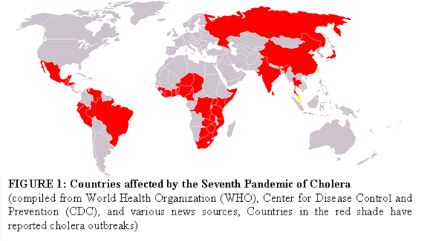
Cholera: Cholera, an acute water-borne diarrheal disease, continues to be a significant global health threat. The ongoing seventh pandemic of cholera, which started in 1960s, has been reported in over 50 countries and has affected over 7 million people. The disease remains a public health threat in many tropical regions of the world, specifically in coastal areas of South Asia, Africa, and Latin America (Figure 1). The causative agent of cholera, Vibrio cholerae, can survive and proliferate in two distinctively different environments: the micro-environment of the human intestine and the macro-environment of coastal and estuarine waters. A deep disciplinary focus on examining micro- and macro-environmental factors has produced an extensive body of information about cholera. Despite steady accumulation of knowledge of V. cholerae in respective research fields, we are not yet able to predict when and where the next cholera epidemic will strike. Since V. cholerae exists naturally in aquatic habitats with important ecological functions and there is powerful evidence of new biotypes emerging, it is highly unlikely that cholera will be eradicated.
The coastal regions of South Asia, for example Bangladesh, have a long history of cholera outbreaks and are collectively considered the native homeland of the cholera disease since the early 19th century. Cholera incidence data at the International Center for Diarrhoeal Disease Research in Bangladesh (ICDDR,B) is well documented and is perhaps one of the longest and most detailed cholera datasets in the world. Cholera incidence time series in Bengal delta is unique in a sense that it shows two cholera outbreaks in a given season. We hypothesized that spring outbreaks are the results of intrusion of coastal water in Bay of Bengal (BoB) aided through low river discharge while autumn cholera outbreaks are the result of flooding caused by high river discharge. Cholera incidence in this region have been historically linked to environmental and climate variables such as precipitation, floods, river level, sea surface temperature, coastal salinity, dissolved organic material and fecal contamination. The above studies on Bengal Delta cholera dynamics primarily focused on environmental and climatic variables with a single annual peak – and consequently were unable to identify the underlying seasonal processes or drivers behind the dual peaks.
Cholera and Remote Sensing: Almost all major cholera epidemics start in the coastal regions (Figure 1), indicating a strong link between estuarine and riverine water systems and outbreaks of the disease. From initial outbreaks in coastal regions, cholera then spreads to inland areas through river network. Cholera bacteria attach to zooplankton, especially copepods, to form a thin biofilm. Since copepods feed on phytoplankton, a high correlation is expected between copepods and phytoplankton. Consequently, observed abundance in phytoplankton may correspond to an increase in the number of cholera bacteria. The causative agent of cholera outbreaks, V. cholerae, cannot be measured from space. However, the bacteria shows strong affinity with plankton blooms which can be estimated from satellites by measuring chlorophyll present in plankton. Chlorophyll, a key biochemical component that gives plants its green color, is responsible for facilitating absorption of sunlight for photosynthetic purposes. Currently, satellite measured chlorophyll is the only effective way to monitor space-time variations of plankton abundance over large coastal areas. Potentials of using remote sensing data (such as chlorophyll, SST etc) for understanding cholera dynamics across a range of spatial and temporal scales has been highlighted in several studies, however, it is not elaborative on the precise role of remotely sensed variables for understanding cholera dynamics.
What do we not know about cholera and remote sensing?
A closer look at relationship between cholera and remote sensing reveals limited understanding of what remote sensing data can offer for establishing coastal and hydrological connections with cholera incidence. Satellite remote sensing provides estimate of chlorophyll, a surrogate for phytoplankton abundance. Phytoplankton concentrations are found to be considerably higher near the coastal zone (210 – 22.50 N and 86-930E) of the Bay of Bengal (BoB). The coastal zone of the BoB also shows high chlorophyll variability compared to relatively constant values away from the coast. There is limited understanding on the inter- and intra-annual variability of chlorophyll in coastal regions and its relationship with cholera incidence.
Satellite chlorophyll data is available at various scales such as daily, monthly, annual etc. There is incomplete understanding on how the space-time variability of phytoplankton affect cholera dynamics and what are the dominant time scales of phytoplankton and its controls on cholera outbreaks. Using chlorophyll and SST, several other studies from various ocean basins across the globe, suggest an inverse relationship between phytoplankton and SST. Phytoplankton blooms occur in cold ocean waters, however, in BoB, phytoplankton and SST are positively related. However, such a positive relationship between SST and phytoplankton breaks down as we move away from the coastal areas. Why do we observe positive association of SST and phytoplankton in BoB? How does the timing and location of phytoplankton bloom and SST variation affect the timing of cholera outbreak?
Prediction of cholera outbreaks remains an unresolved puzzle. V. cholerae exists naturally in brackish waters, and because of the growing evidence of new biotypes emerging, it is unlikely that cholera will ever be eradicated. We proposed the role of rivers in two peaks of cholera outbreaks in Bengal delta. What are the geophysical drivers which can be used for prediction of cholera outbreaks? For example, Magny et al (2008) suggested that chlorophyll may be used as a predictor variable for cholera outbreaks in Bengal Delta, however, the study did not elaborate, if chlorophyll can predict seasonal double peak cholera outbreaks for this region. Identification of appropriate predictor variables is important to understand cholera dynamics for the region.
What is our motivation?
Based on the empirical findings, four observations motivate me to explore the connections among coastal ecology, hydrology, and epidemiology of cholera and develop prediction model using recent advances in remote sensing: (a) cholera incidence in Bengal delta is unique with two seasonal peaks which are controlled by two separate hydrological processes; (b) major cholera outbreaks have originated near coastal areas; laboratory and field studies have shown significant positive correlation between zooplankton and cholera bacteria; (c) remote sensing provides unprecedented coverage of space-time measurements of phytoplankton variability in coastal regions and (d) most ocean basins show an inverse relationship between chlorophyll and SST, a positive relationship exists between SST and chlorophyll near the coastal areas of the BoB. Recent advances in remote sensing, via spatial and temporal coverage of satellites, can provide relevant data (such as chlorophyll, colored dissolved material, SST, sea surface height) to monitor environmental conditions favorable to cholera outbreaks. Therefore, it is important to establish relationships between environmental variables for comprehensive understanding of cholera dynamics.
What are our Goals and Objectives?
The overall goal of the proposed research is to develop a cholera prediction model with two tothree months prediction lead time, using primarily remote sensing data.
Findings from these four objectives are expected to provide comprehensive understanding of hydro-coastal controls on cholera dynamics and potentials for using remote sensing data for developing a cholera prediction model.
What are our current findings?
Our current findings are summarized in the following selected publications, conference proceedings and presentations.
Jutla, A.S., A.S. Akanda, and S. Islam, 2010. “Predicting Cholera Outbreaks from Satellites.” Remote Sensing of the Environment. (In Review)
Akanda, A.S., A.S. Jutla, A. K. Siddique, M. Alam, R.B. Sack, A. Huq, R.R. Colwell and S. Islam, 2010. “Hydroclimatic Influences on Seasonal and Spatial Cholera Transmission Cycles: Implications for Public Health Intervention”. Water Resources Research (In Revision).
Jutla, A.S., A.S. Akanda, and S. Islam, 2010. “Spatio-Temporal Variability of Chlorophyll-a in Bay of Bengal”, Remote Sensing of the Environment. (In Revision)
Jutla, A.S., A.S. Akanda, and S. Islam, 2010. “Tracking cholera in coastal regions using satellite observations.” Journal of American Water Resources Association. 09-0111-P.
Akanda, A.S., A.S. Jutla, and S. Islam, 2009. “Dual peak cholera transmission in Bengal Delta: A hydroclimatological explanation”, Geophysical Research Letters, 36, L19401.
Conferences and other Publications
Akanda, A.S., Jutla, A.S., and S. Islam. 2010. Rivers as Corridors of Diarrheal Disease Transmission: Role of Coastal and Terrestrial Hydroclimatology. Proceedings of the American Geophysical Union, Foz do Iguacu, Brazil, August 8-12.
Jutla, A.S., Akanda, A.S. and Islam, S. 2009. Satellites and Human Health: Potential for Tracking Cholera Outbreaks. Proceedings of the American Geophysical Union, San Francisco, California, December 14-18.
Islam, S., Jutla, A.S., Akanda, A.S. 2009. Integrating Terrestrial Hydrology and Coastal Ecology: Understanding Cholera Dynamics using Remote Sensing Data. Proceedings of the American Geophysical Union, San Francisco, California, December 14-18.
Akanda, A.S., Jutla, A.S., and Islam, S. 2009. Climate Extremes and Infectious Diseases: Large Scale Hydroclimatic Controls in Forecasting Cholera Epidemics. Research Day on Global Health and Infectious Disease, Tufts University, USA. October 5.
Jutla, A.S., Akanda, A.S. and Islam, S. 2009. Relationship between Phytoplankton, Sea Surface Temperature and River Discharge in Bay of Bengal. General Assembly of the European Geosciences Union, Vienna, Austria, April 19-24.
Jutla, A.S., Akanda, A.S. and Islam, S. 2009. Spatio-Temporal Variability of Chlorophyll in Bay of Bengal. General Assembly of the European Geosciences Union, Vienna, Austria, April 19-24.
Akanda, A.S., Jutla, A. S., and Islam, S. 2009. Bimodal Explanation of Cholera in Bangladesh: A hydroclimatological explanation. General Assembly of the European Geosciences Union, Vienna, Austria, April 19-24.