-
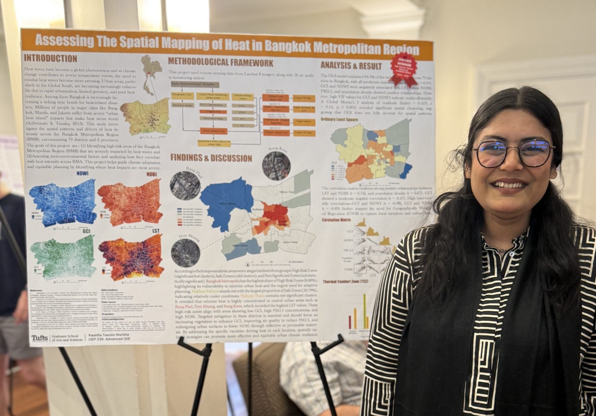
2025 GIS Expo Winners
Thank you for everyone that attending the 2025 GIS Expo. We had 221 posters and 60 StoryMaps displayed at the GIS Expo. It was a wonderful day with great turnout and lots of energy. Congratulations to everyone that submitted a GIS project – this year’s research and student work was truly incredible. You can view…
-
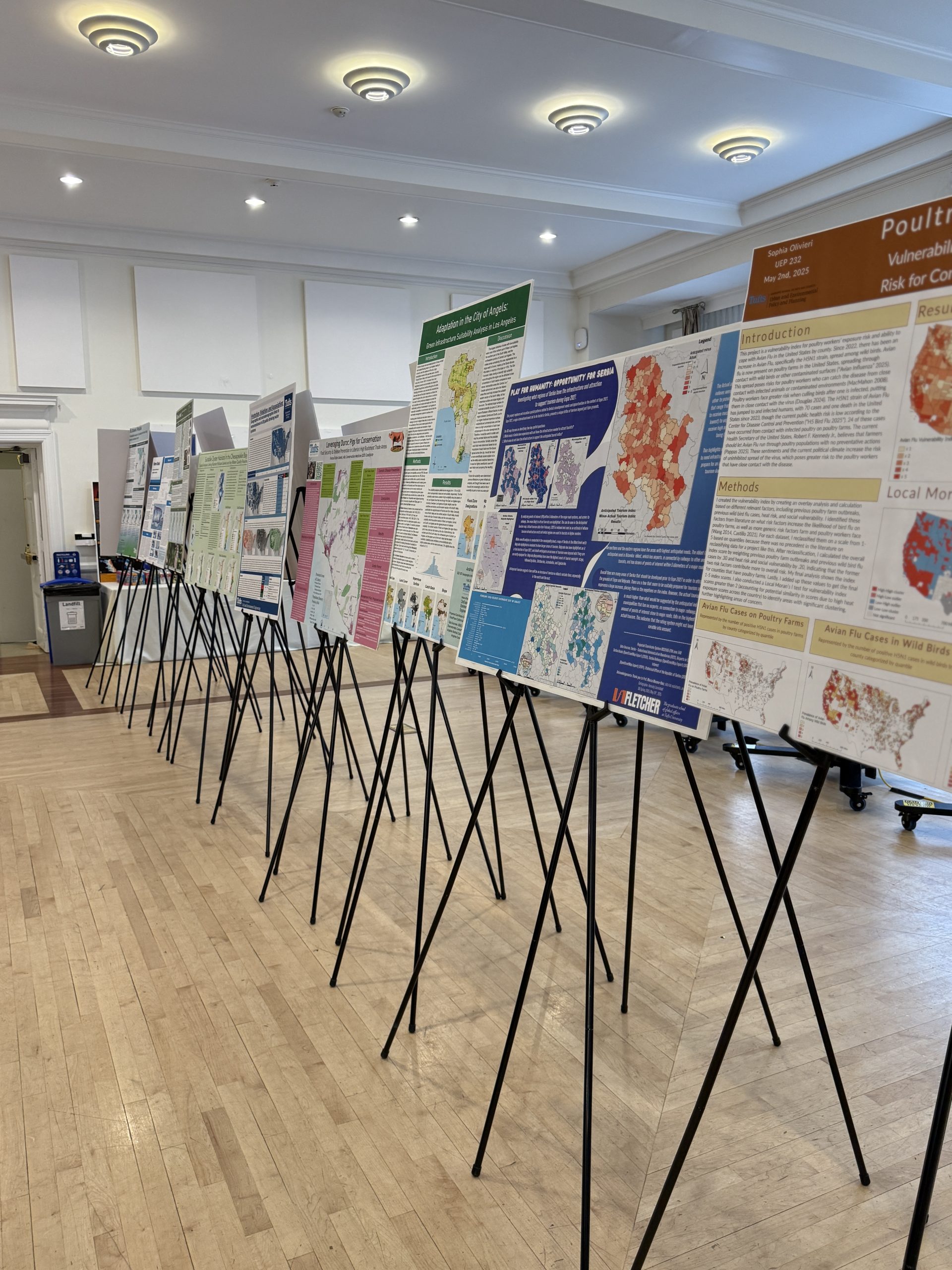
Tufts GIS Expo Showcases 281 projects from 2024 – 2025!
Tufts GIS does it again! This year, TTS Research Technology and the Data Lab showcased 281 GIS projects completed by Tufts GIS students. We had 221 posters and 60 StoryMaps displayed at the GIS Expo. It was a very packed event, with lots of energy and an incredibly wide range in topics and applications! Check…
-
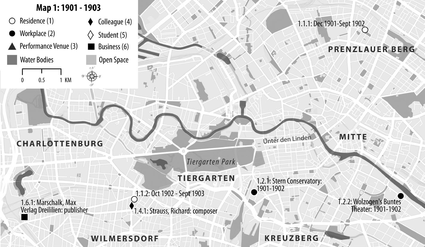
Schoenberg’s Three Berlins: A Sneak Peak into Professor Joseph Auner’s Article in the Edited Collection titled “Schoenberg in Context”
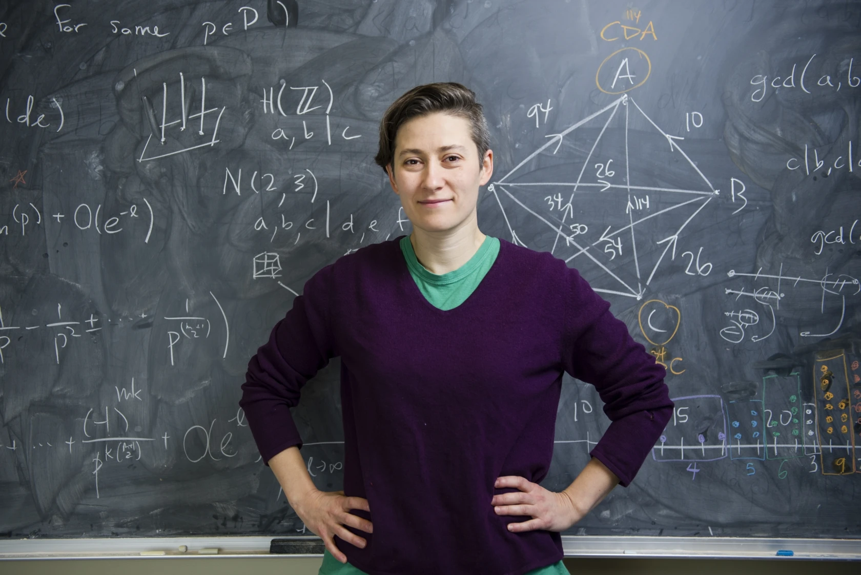
TTS Research Technology’s GIS & Data Lab Services Manager, Carolyn Talmadge, and Chris Barnett, Principal Software Engineer, had the honor of working with Professor Joseph Auner, Professor in the Department of Music at Tufts University, to help create three maps of Arnold Schoenberg’s life in Berlin during three distinct time periods. These maps are featured in…
-

Looking at Ancient Roman Plagues Through an Environmental Lens
Environmental archaeologist Brandon McDonald builds a better understanding of antiquity by looking at the interplay of climate, environment, and disease. Apit of human bones, potential evidence of a catastrophic epidemic that struck Constantinople in 541 A.D. Sulphur deposits trapped in polar ice, showing traces of a series of massive volcanic eruptions. For Brandon McDonald, these seemingly…
-
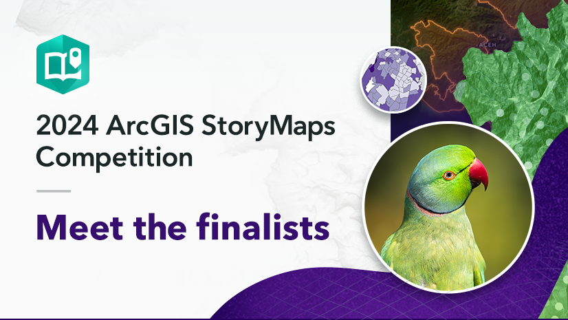
2 Tufts Students are finalists in the 2024 ArcGIS StoryMaps Competition
Tufts students Jacqueline Powers (Community Health and Public Health) and Julia Huber (The Fletcher School) are finalists for their oustanding GIS class projects. Click on the images below to read their stories: ———- From September 6 to December 6, 2024, over 570 storytellers from 58 countries submitted stories in 10 languages to the 2024 ArcGIS StoryMaps Competition. Read all the finalist submissions…
-

Tisch Library helps with Data Rescue Project 2025
Tisch librarians have been collaborating with libraries across the country and collaborators from various sources, including IASSIST, RDAP, Data Curation Network, BlueSky, LinkedIn, and others. Resources are being shared and catalogued here: http://tinyurl.com/DataRescueProject2025 You can also check out Tisch’s research guide on accessing archived data sets
-

Love Data Week 2025 at Tufts
Love Data Week is an international event held annually around Valentine’s Day to celebrate data and promote awareness of its importance in research, education, management, sharing, preservation, and reuse. Tuesday, February 11, 2025 (12 to 1 PM): From Script to Print: Transcribing Archival Documents with Handwritten Text Recognition Wednesday, February 12, 2025 (12 to 1 PM): Analyzing…
-
Who Deserves to Die? The Moral Logic of Mau Mau Killings in Colonial Kenya, 1952–56
H. Muoki Mbunga, Ph.D, Assistant Professor of History at Tufts University published an article in The Journal of African History titled “Who Deserves to Die? The Moral Logic of Mau Mau Killings in Colonial Kenya, 1952–56“. Carolyn Talmadge, GIS & Data Lab Services Manager in TTS Research Technology, had an excellent opportunity to collaborate with…
-
Data Lab Assistant and Tufts Senior Jeannine Pecoraro is first Drone Class student to pass her pilot exam
Jeannine Pecoraro is a senior at Tufts double majoring in Philosophy and Environmental Studies with a minor in cognitive brain science. As a Data Lab Assistant, she provides support to students in GIS coursework and projects. She has taken many of the GIS classes at Tufts, including the inaugural class of ENV 121: Drones for…
-

Reconstructing the Large Scale Olive Oil/Agricultural Economy of North Africa in the Roman Empire
Professor R. Bruce Hitchner‘s project using remote sensing, AI, and GIS secured a Springboard grant of $34,788.08 from the Office of the Provost! The team is applying for additional funding, including a grant from the National Endowment for the Humanities. Dr. Hitchner is working with collaborators from Tufts Technology Services (TTS) and international colleagues to…
-

How a Tufts University Professor Blended GIS and Conservation Medicine
Before students at Tufts University finish the Master of Science in Conservation Medicine (MCM) program from the Cummings School of Veterinary Medicine, there’s one requirement they may not have anticipated being key to their future careers: a geographic information system (GIS) course. The MCM program brings together veterinarians, physicians, ecologists, and conservation professionals committed to…
-
MCM Students Garner Prestigious Awards and Grants for their Work
Honors include the Lily Glidden Award, Tufts Elephant Conservation Alliance (TECA) student grant, and three awards at the ESRI User Conference
-
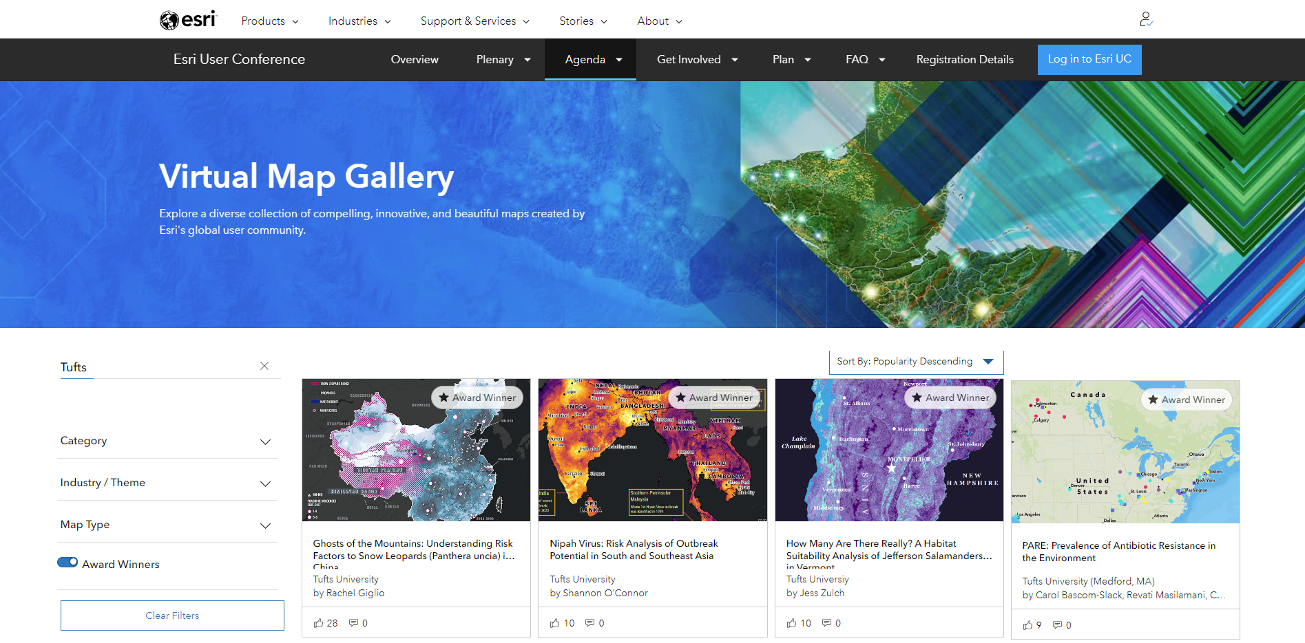
Tufts Wins Four Prizes at ESRI UC 2024
Tufts has done it once again! Congratulations to the winners of the ESRI Map Gallery at the 2024 ESRI User’s Conference out in San Diego, California! This year Tufts University had 3 students and one faculty led project win awards at ESRI’s Map Gallery! Check out the amazing projects and award winners submitted by Tufts…
-

Using ESRI’s Experience Builder to Create a Project Gallery
If you’re like us here at Tufts University, you might be interested in displaying your students GIS (or other types of) projects in an interactive gallery application! We searched for the right tool for weeks just to figure out that ESRI has the perfect app for what we wanted to do (no big surprise there!).…
-
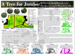
Check out the Winners of the 2017 GIS Poster Expo!
Best in Show: Michael LaScaleia A Tree for Jumbo: Reforesting the Tufts University President’s Lawn to Historic Levels Elisabeth Spratt Swamped: Proposing wetland restoration corridors in Mississippi’s Tallahatchie watershed Runners Up: Jennifer Yu Quintessential One Health: A Bovie Tuberculosis Risk Analysis in South Africa Song Hojun Vulnerability Assessment : Syrian Refugees in Turkey in 2017…
-
-
-
-
-
-
-
-

Announcing the 2016 GIS Poster Expo Winners
Best in Show: Sharon Ron, Intro to GIS for Urban Analysis Location, Location, Location: Analysis of Monthly Rental Premiums in the Greater Cambridge Area Stephanie Cleland, Advanced GIS The Intrinsic Vulnerability of Groundwater to Contamination in the Midwest and its Associated Human Health Impacts Sydney Giacalone, Undergraduate Intro to GIS The Political Implications of “Food…
-
Website Seeks to Make Government Data Easier to Sift Through
Website Seeks to Make Government Data Easier to Sift Through Link to New York Times Article For years, the federal government, states and some cities have enthusiastically made vast troves of data open to the public. Acres of paper records on demographics, public health, traffic patterns, energy consumption, family incomes and many other topics have…
-
Map Quest: Tufts students and faculty make creative use of Geographic Information Systems (GIS)
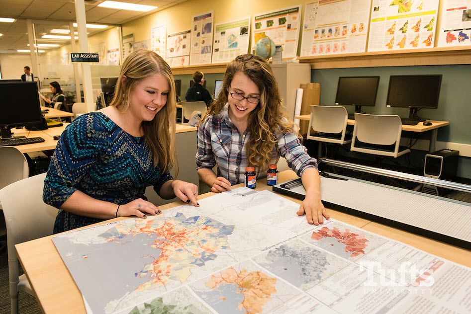
Check out the article about Tufts’ new Data Lab on the front page of the Arts & Sciences Website! by Blake Coolidge, A17 The newly expanded Data Lab on the Tisch Library’s second floor is lined with poster-sized infographics and maps created by Tufts students using geographic information systems (GIS) technology. The design of the…
-

Annual GIS Poster Expo Highlights Student Research
Check out this Tufts Technology Services article written about the Tufts Annual GIS Poster Expo! Annual GIS Poster Expo Highlights Student Research Randolph Pfaff Tuesday, June 23, 2015 – 12:00pm What do aircraft noise in Denali National Park, economic development in Colombia, public housing challenges in Chicago, and the California drought have in common? They…
-

Special Tufts Crisis Mapping Special Journal Edition
Tufts Patrick Florance guest edited a special Crisis Mapping Edition of the Journal of Map & Geography Libraries 8 (2). The edition contains articles from Tufts Alums Patrick Meier, “Crisis Mapping in Action: How Open Source Software and Global Volunteer Networks Are Changing the World One map at a Time and Simcha Levental, “A New Geospatial Services…
-
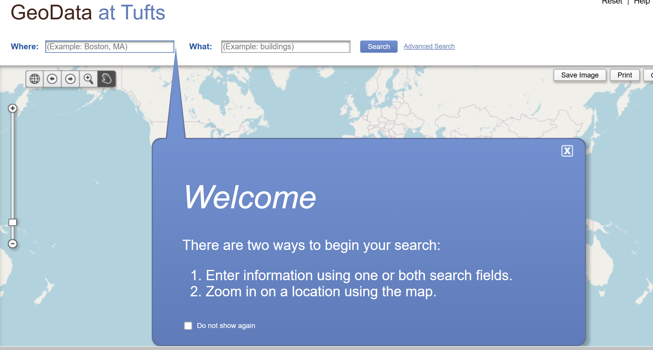
Tufts Geoportal Live: GeoData@Tufts
Tufts UIT would like to announce the launch of GeoData@Tufts: a collaboratively developed, open source, federated web application to rapidly discover, preview, and retrieve geospatial data.