The Data Lab is involved in a number of projects around Tufts University. From working on faculty and student publications, to creating interactive dashboards and applications, we do it all! Below are highlights from some of our favorite projects! Check them out.
Tufts University: Emergency Blue Light Locations
Sponsored by Tufts University Public Safety.
Tufts Grafton Campus Biodiversity Assessment – 2016
The Data Lab Renovation: Summer 2015
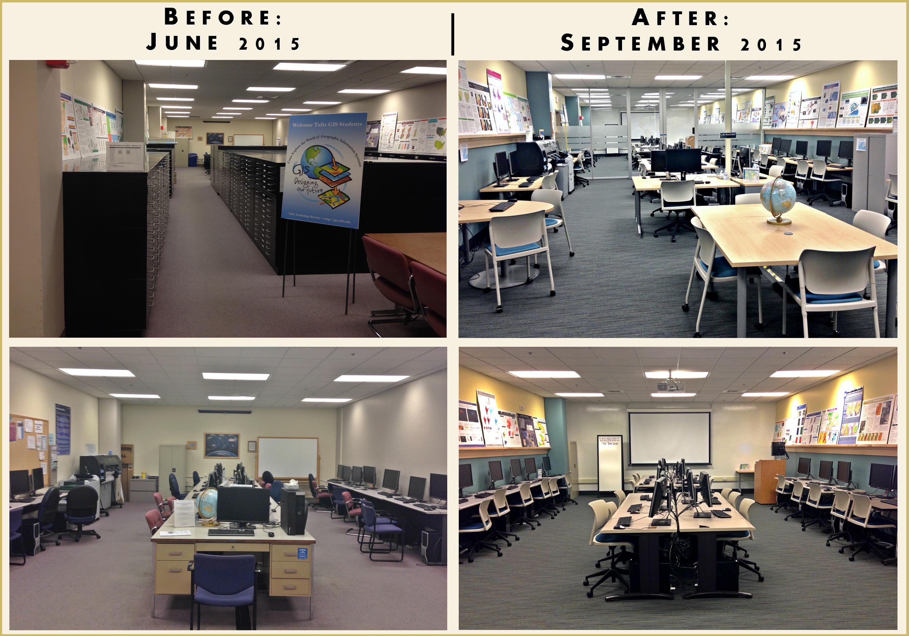
In the summer of 2015, the Data Lab (formerly the GIS Center) underwent a complete remodel. We started with 20 computer labs tucked in the back of a dark and dungy map room, to having over 50 workstations in a vibrant and inviting space. Miraculously, we were able to complete this project in just 3 short months. Take a look at our PowerPoint too see the complete renovation process – from demo to completion!
Shahzia Sikander: Parallax – Fall, 2015
In the fall of 2016, we worked on a project for artist, Shahzia Sikander, who had an exhibit called Parallax at the Tufts Art Gallery. For this project, Carolyn Talmadge, our GIS Specialist, created two murals showing the locations of Shahzia’s artistic influence. Aishwarya Venkat, one of our GIS Lab Assistants, created an interactive web-map showcasing routes and terrains that were particularly inspirational for the artist and Chris Barnett, our Geospatial Analyst, created the following video highlighting the artist and her work.
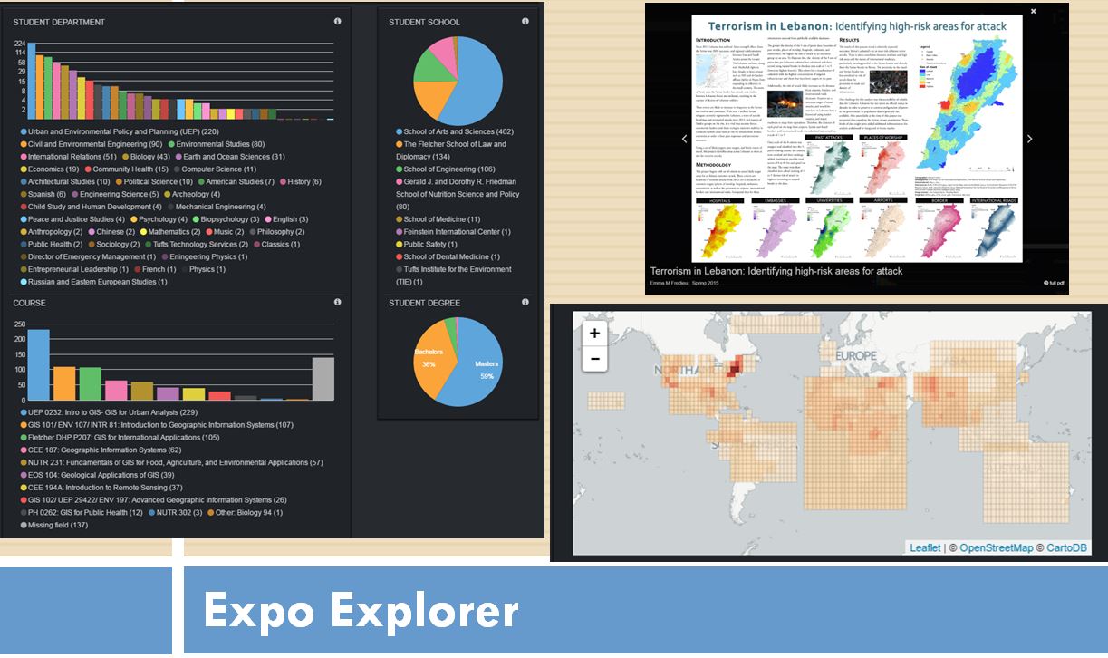
The GIS Poster Expo Explorer
In 2016, the Geospatial Technologies Team developed an web-application search tool known as the GIS Poster Expo Explorer. The Expo Explorer Application is a search and discover tool which allows users to interactively view GIS Posters from 2007 to current. This tool allows users to search by Topic, Subtopic, Methodologies, Student Depart, Class, Year, and more in order to view the geospatial research being completed across all three of our campuses!
The Open Geoportal
The Open Geoportal (OGP) is a collaboratively developed, open source, federated web application to rapidly discover, preview, and retrieve geospatial data from multiple organizations. The project is lead by Tufts University along with Harvard and MIT. Several other partner organizations are assisting with the development.
GeoData@Tufts is the Tufts Geospatial Data Repository which allows you to search, discover, preview, interact, and download geospatial data from university repositories. This is an excellent place to start looking for data!
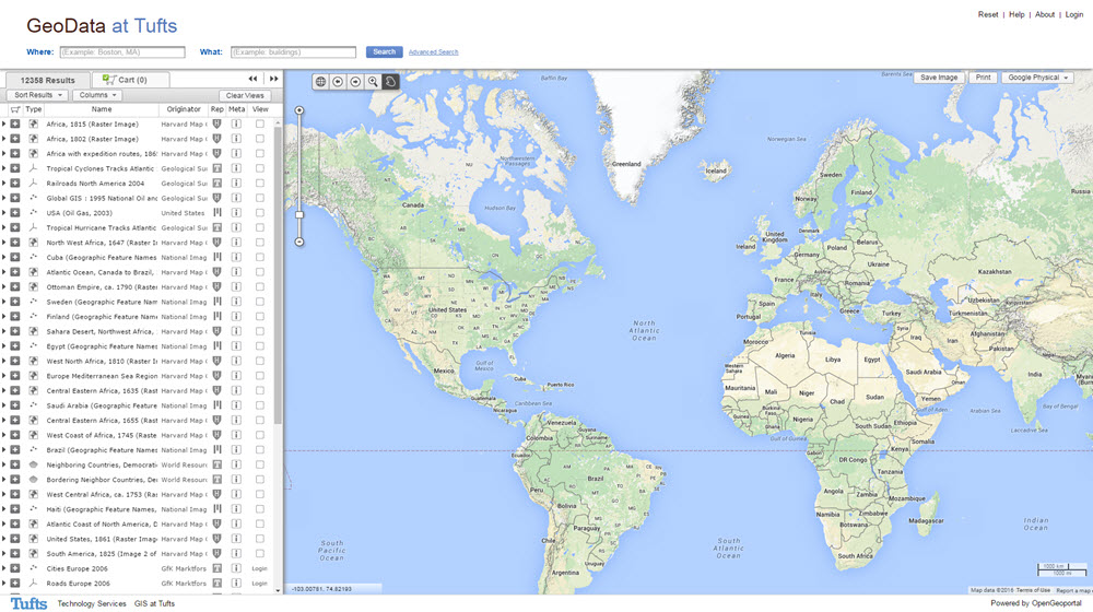
OGP 2.0 is the most current release. which includes a new enhanced interface, interoperability for several web mapping platforms, etc The project’s code repository is hosted on github. Installation instructions are in the repository’s README.
Boston Climathon 2015
Boston was chosen as one of ten cities worldwide to participate in the Global Climathon 2015, an intercontinental hackathon event to find innovative, city-level solutions to climate change problems.
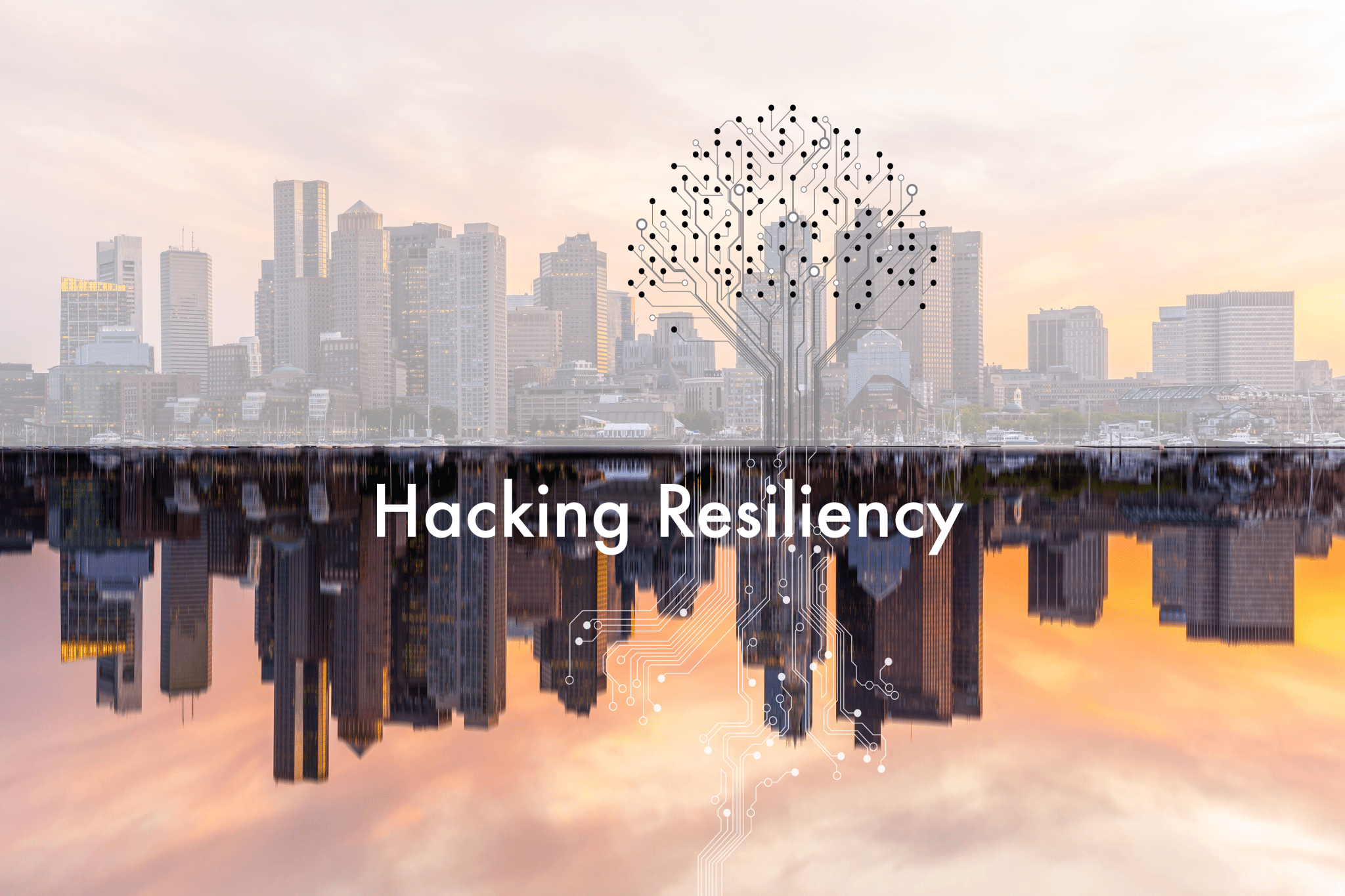
Set to take place simultaneously in major cities across the world, the Global Climathon challenged students and citizens from diverse locations to take direct climate action within their own municipalities. As one of two cities (along with Washington, D.C.) chosen to represent North America in this global initiative, the Boston Climathon — Hacking Resiliency leveraged the wealth of creativity and innovation that greater Boston has to offer, while enhancing climate literacy, skills, and urgency within our own communities.
On June 18th, 2015, Tufts Institute of the Environment lead the New England regional marathon to develop solutions for climate change resiliency related to sea level rise in the greater Boston area. Local water, climate, and sustainability officials, experts, and developers helped frame the challenges we face, and inspire potential solutions for participants to explore. This was an excellent opportunity for students and citizens of all skill levels to develop or add to their knowledge in the areas of climate change resiliency and adaptation, environmental justice, app development, mapping, GIS, and data management tools.
Check out the presentation created by Tufts University to understand how Geospatial Technologies can help answer these questions!