Rethinking Class Sessions to Teach a Difficult Concept
Barbara Parmenter teaches the Introduction to Geographic Information System (GIS) course in the Department of Urban and Environmental Policy and Planning. She reflects on her experience of planning and executing redesigned class sessions as part of her recent participation in the Teaching with Technology Seminar.

What motivated you to redesign a series of class sessions?
I am always interested in improving my teaching, but committing to changing something is always not an easy task. But, when Tufts Educational Technology Services offered to provide dedicated support and encouraged me to pick single difficult module to work with, rather than rethinking the course as a whole, I decided to put my ideas into practice this time.
The basic goal was to present information better with the hopes that students will be able to retain it long term. I picked the topic of coordinate systems and map projections because students had troubles with it historically and it is so foundational. I first identified four class sessions that build on each other in teaching this concept, so I could accomplish several learning goals associated with the concept. Then, I carefully redesigned pre-class and in-class activities in order to encourage them to think and process the information they learned in each phase.

What did you do to make students accountable for pre-class work?
All homework and in-class exercises were directly tied to completing a graded portion of their ongoing semester-long project, so there was an immediate application of their practice. Also, I required their participation, but the answers were not graded.
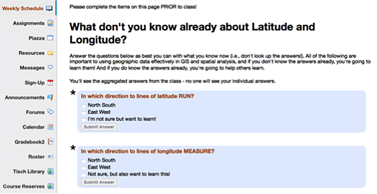
There were three specific enhancements that I think worked well in holding students accountable for their pre-class work. First, I introduced a pre-class quiz on latitude and longitude using the Question tool in Trunk’s Lesson Builder, so the students could see what they knew and what they had to learn. Prior to the redesign, I would normally have them download and use Google Earth, but I did not do anything to ensure they did it. I assumed students understood the concepts. Then I would realize that they didn’t. To their surprise, students got a lot of questions wrong. This established that they did not know as much as they had initially thought and would push them to complete the Google Earth exercise to learn about it. The Question tool allowed me to see the aggregate scores of how everyone did overall and where they struggled. It also allowed the students to get immediate feedback. This was very helpful for them and for me as well, because before I had just assumed that students knew latitude and longitude, but in actuality they were struggling with the concepts.
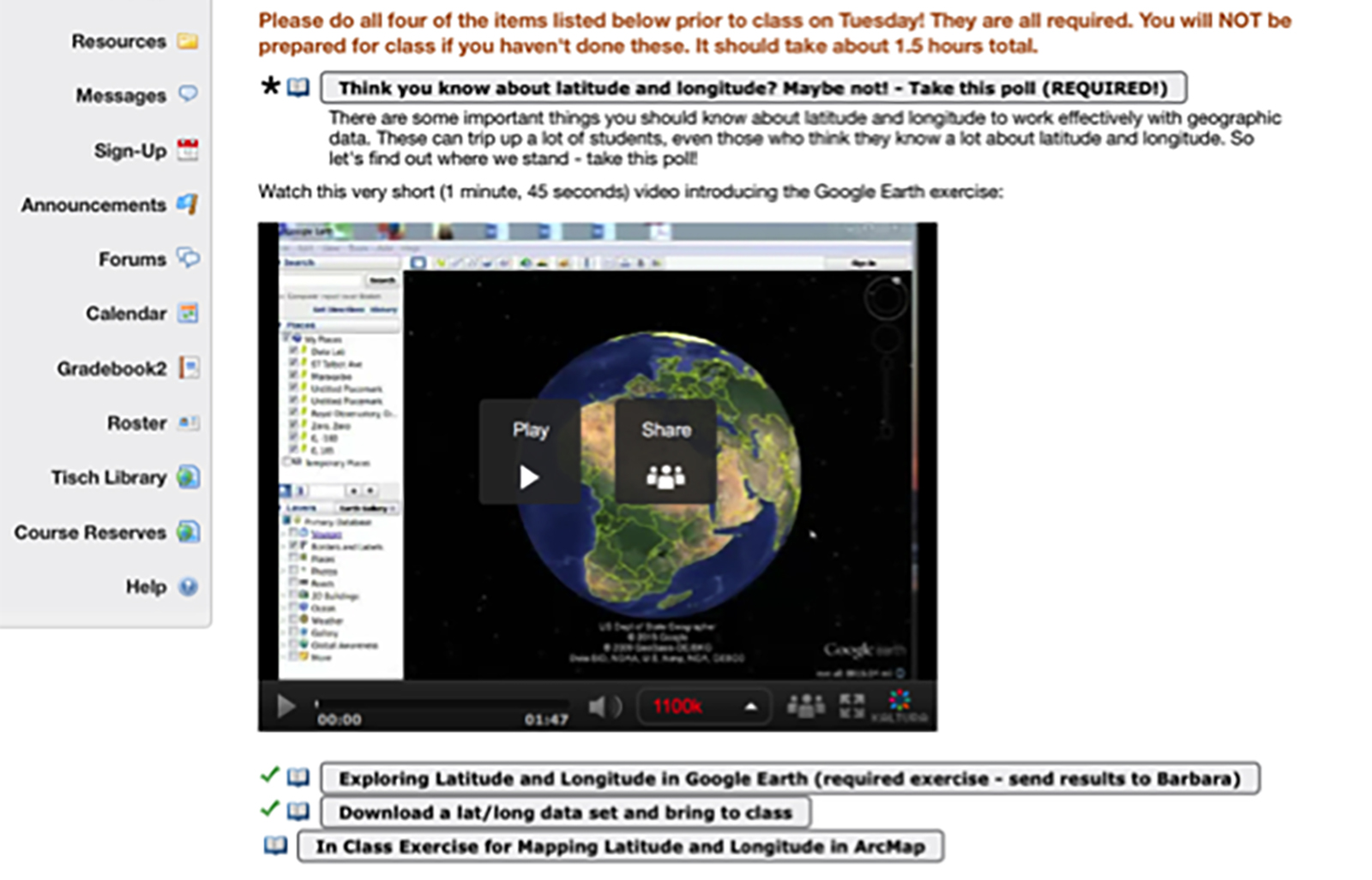
Second, in addition to text-based reference materials with the steps for students to follow, I used videos to either illustrate the concepts or get students excited about it. I thought about creating a narrated PowerPoint video, but, I chose to create interactive demonstration videos to teach the multidimensional concept and visuals they need to learn about coordinate systems. I made a few screen-recorded videos with Camtasia, using Google Earth as a medium to help students conceptualize the material better. These videos were ten minutes long and provided an overview of the concepts, which then I later expanded on discussing in class. I also flipped the exercise I used to do in class called “playtime.” To get students excited about projections, I asked them to watch a particular episode of The West Wing, a TV show, that is related to this concept. Students then had fun with their own playtime of a thirty minute exercise using ArcGIS as homework. When they came to class, I concentrated more on the two major coordinate systems that students will be using all the time.
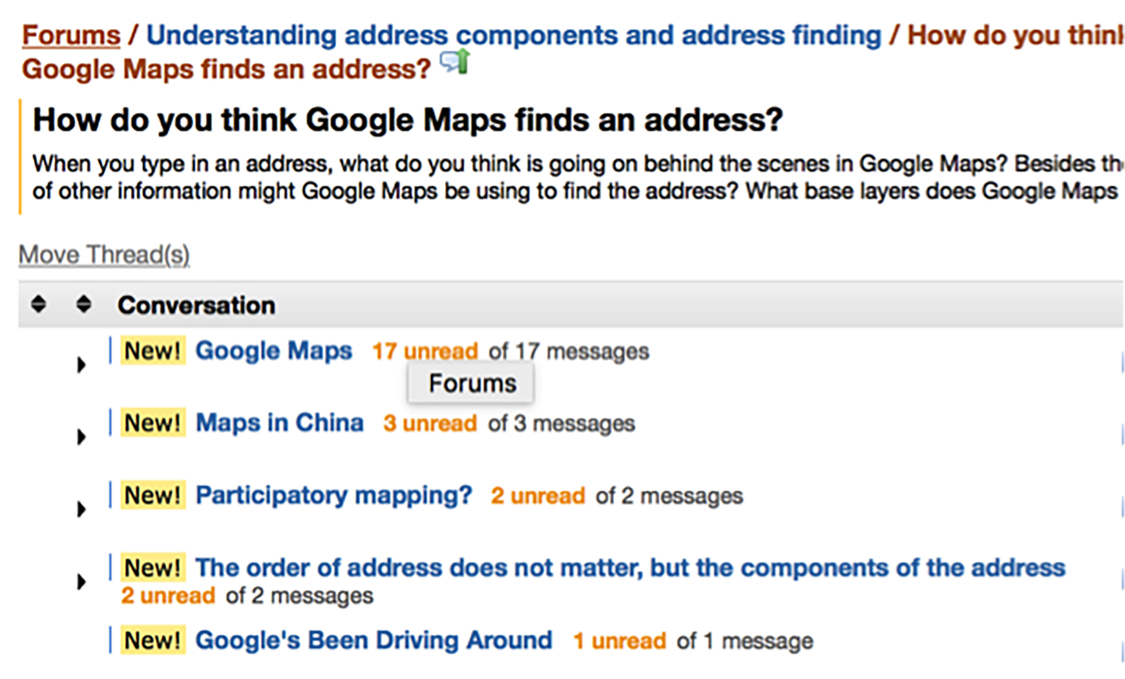
Third, for the topic of address geocoding, where teaching critical thinking is required, I asked students to use Google Maps, which students use every day, and discuss a series of questions I posed in the Trunk Forum prior to class. The learning objective was to train students to become more effective and critical users of the point data—rather than just assuming somehow that the data is accurate, I was hoping students would see, by doing that address geocoding themselves, that geocoding is hard and its not always accurate. The questions were directed to reveal the information that students would not normally think about such as typing a full address versus a street name only or exploring a rural area. For international students, I encouraged them to find their homes or a place they know and tell us what happens. “What do you think is happening behind the scenes when Google Maps does this and tries to find an address?”
What do you hope to accomplish next?
The students definitely were more active and curious with these rearranged class sessions. I like the idea of processing info in a way that tweaks their curiosity so it makes them want to do the next step. Some really interesting things came up and students were vocal about things they discovered and we all learned in the process. . One lesson that I learned was that I concentrated too much on the pre-class assignments rather than the in-class engagement. In a couple sessions, we ran out of time to complete the exercise. So, if I want to accomplish planned exercises in class while addressing pre-work, I need to pay more attention to that. For example, I need to shorten the text of my in-class exercises since students differ in their pace of reading. But that is very feasible. Another major lesson for me to realize that I can make small tweaks, one module at a time, rather thinking I need to change the course dramatically.
By the end of the semester, I can definitely say that my students are implementing what they learned more effectively than in the past – that is, there are a lot fewer problems appearing related to map projections and coordinate systems on their final projects than there have been in the past. Curiously, they still have trouble actually articulating differences between projections that I think they should know (that is they have difficulty answering questions about projections), yet they are able to apply their knowledge when they are doing mapping and spatial analysis. So that’s a mystery to me to think about over the summer! But I am pleased with the overall results and I look forward to making it even more effective next time around.